
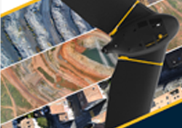
Map without limits
The eBee X is the fixed-wing drone for all your mapping needs. Designed to boost the quality, efficiency and safety of your data collection, it has a camera to suit every job, the accuracy and coverage to meet every project’s requirements, and can work virtually every type of site.
3 reasons to choose the eBee X
1. Efficient & PreciseEnjoy vast coverage of up to 500 ha (1,235 ac) at 122 m (400 ft) by activating eBee X’s unique Endurance Extension.
2.Rugged & Reliable
The eBee X allows you to work virtually every site, no matter how demanding, thanks to its space-friendly Steep Landing technology, ultra-robust design, live air traffic data and more—all backed by senseFly’s trusted professional, local support.
3.Multi-purpose
The eBee X suits every job thanks to its range of groundbreaking cameras. These include the new senseFly S.O.D.A. 3D, for stunning 3D reconstructions of vertical environments, the best-in-class senseFly Aeria X RGB photogrammetry camera and the senseFly Duet T for creating geo-accurate thermal maps.
The eBee Plus in a uniquely flexible tool. It is available with multiple camera payloads, so you need only invest

Video Unboxing
Technical Specification

Video quick setup preview
Download Brochure
Pricing & Availability
Please fill out enquiry Form ( Click here )